Hanoi to build culture and tourist park on alluvial islet in Red River
Hoan Kiem District’s authority plans to build a recreational area in the alluvial islet in the Red River.
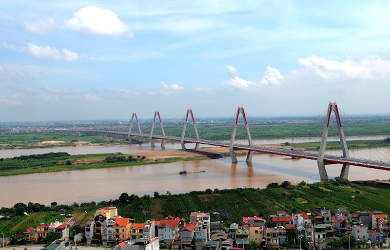
The Hoan Kiem District People's Committee of Hanoi is planning the development of an alluvial islet in the Red River, making it a cultural and tourist park to exploit the potential and advantages of the natural beauty of the Red River.
| The area across the Red River. Photo: kinhtedothi |

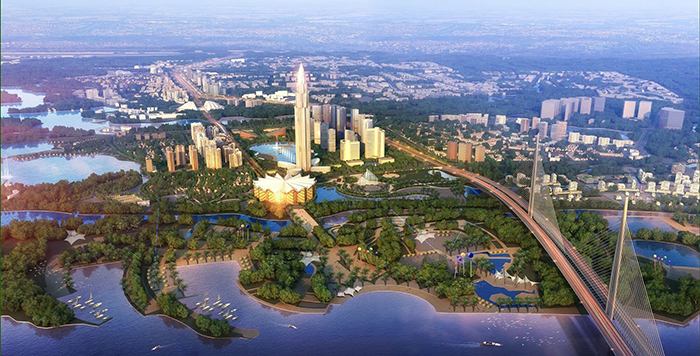
The cultural tourism park will be built based on the inherent natural terrain. It will become a place of gardens and cultural tourism spaces associated with Hanoi and the Red River’s history, traditional customs and habits, and culture.
In the alluvial islet, the district’s authority plans to arrange a functional area for agricultural and tourist landscapes, in which local households will be allowed to grow short-term crops for visitors to visit, take photos and enjoy the specialized fruit trees.
Here, the lawn will be interspersed with existing perennials to create greenery. In addition, spaces for entertainment and sports, areas for fishing, swimming and diving, and river sightseeing will also be created.
In the Red River riparian area, the Hoan Kiem District’s authority will build a green park in which the existing large trees will be retained. Besides, some acreage will be reserved for functional areas where planting short-term trees, ornamental plants, seasonal flowers will be planted in combination with tourism services.
The project will cover an area of about 11,000 hectares in 13 districts of Me Linh, Dong Anh, Long Bien, Gia Lam, Bac Tu Liem, Tay Ho, Ba Dinh, Hoan Kiem, Hai Ba Trung, Hoang Mai, Thanh Tri, Thuong Tin, Dan Phuong.
According to the city's authority, the Red River planning project is built based on a study of the section of about 40 kilometers along the river, from Hong Ha bridge to Me So bridge. The municipal Departments of Planning - Architecture and Agriculture and Rural Development will advise the City People's Committee to consider and direct the next steps in the planning work.
The city will complete the zoning plans, including the plan on both sides of the Red River, and make full use of the land resources in the riparian areas along the river banks.