Facilitating urban development along Red River’s banks
Although the section of the Red River that flows through Hanoi is relatively short compared to its overall length, it plays a significant role in shaping the city's distinctive cultural and landscape features.
When it comes to bodies of water, the Red River cannot be overlooked, a river that has shaped the cultural landscape and rich history of the country, symbolizing the prosperity of the ancient capital Thang Long and present-day Hanoi.
In the current major urban planning initiatives, defining the development direction for the future, the Red River is consistently identified as the central green axis, fostering harmonious urban development on both banks of the city.
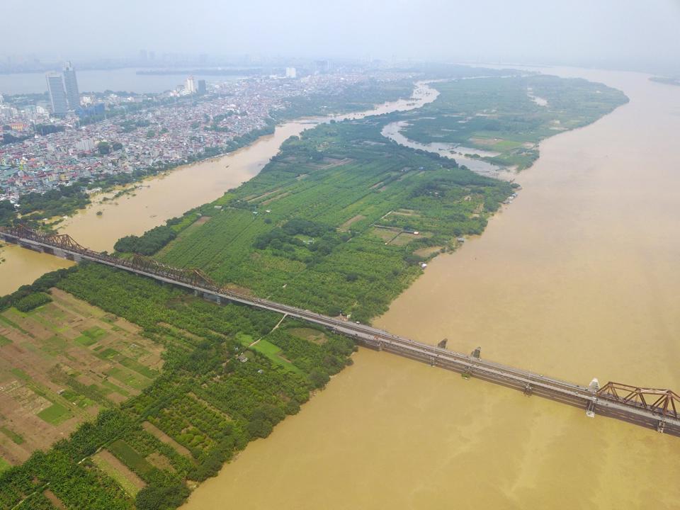
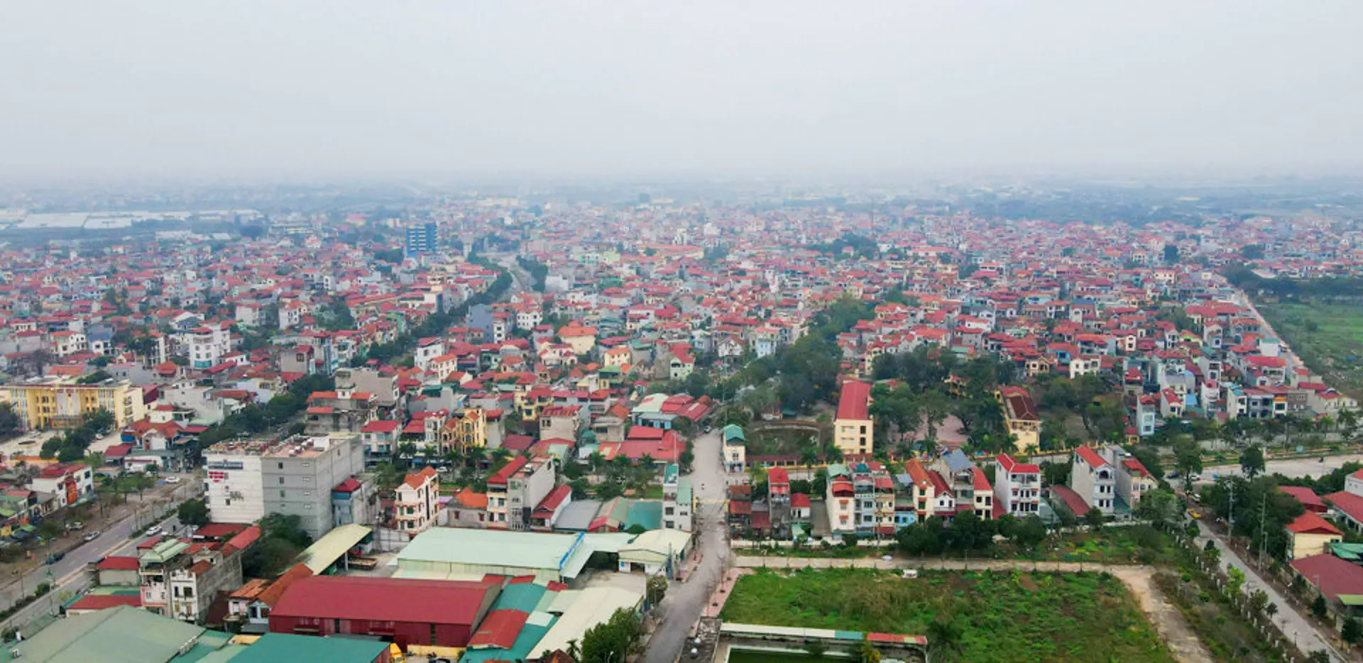
| The Red River crosses the Tay Ho and Dong Anh districts in Hanoi. Photo: Pham Hung/The Hanoi Times |

Creating new values…
Hanoi is a city intricately linked to water bodies, the largest of which is the Red River. With a length of nearly 1,200 km, the river originates in Yunnan Province, China, and flows through Vietnam for about 556 km, of which about 120 km passes through Hanoi (starting from Phong Van Commune, Ba Vi District, and concluding at Quang Lang Commune, Phu Xuyen District).
Nguyen Ba Nguyen, Deputy Director of the Hanoi Department of Planning and Architecture, emphasized that although the section of the Red River flowing through Hanoi is relatively short compared to its overall length, it plays a significant role in shaping the city's distinctive cultural and landscape features.
“Beyond creating fertile agricultural land, the Red River contributes significantly to transportation, economic development, and the creation of green spaces and water surfaces, effectively enhancing the architectural and landscape development of the capital,” said Nguyen.
Recognizing the historical, cultural, and scenic significance of the Red River in Hanoi's development, the General Plan for the Construction of Hanoi Capital until 2030 and the vision until 2050, approved by the Prime Minister through Decision No.1259/TTg on July 26, 2011, designates the Red River as the primary landscape axis of the capital.
The plan outlines basic directions for urban planning along the Red River, such as ensuring approved flood control corridors and constructing a system of parks, scenic green spaces, cultural facilities, entertainment, tourism services, and urban amenities. It also emphasizes the rehabilitation of existing residential areas, ensuring the living quality of communities on both sides of the river, relocating unsafe and poorly constructed housing in the riparian areas, creating cultural and ecological axes along West Lake - Co Loa, and developing scenic walking and cycling routes.
Luu Quang Huy, Director of the Hanoi Institute of Planning, mentioned that to concretize the directions of the General Plan, on March 25, 2022, the Hanoi People's Committee approved the detailed plan for the urban subdivision along the Red River at a scale of 1/5000 (from Hong Ha Bridge to Me So Bridge) in Decision No.1045/QD-UBND, covering an approximate area of 10,996.16 hectares. Of this, the Red River area constitutes about 30% (around 3,244 hectares), and the green space occupies about 49.7% (approximately 5,462 hectares).
Therefore, green spaces and water surfaces make up nearly 80% of the research area, which is in line with the vision of the Red River as a flood relief area and a green axis for central Hanoi. This is a significant step towards transforming the Red River into the central green axis of the capital, turning the dream of a modern, green city on both sides of the river into reality.
…and images for Hanoi
Hanoi is currently developing the Capital City Master Plan for the period 2021-2030, with a vision to 2050, and adjusting the General Plan for Hanoi Capital until 2045, with a vision to 2065, with a significant focus on utilizing the Red River as the central green axis, a scenic landscape for harmonious urban development on both banks. This crucial direction serves as a foundation for unique ideas, urban planning solutions, and organizing attractive landscape spaces on both sides of the river and the central area to create a new image and value for the capital with a thousand years of history.
The landscape axis of the Red River encompasses areas beyond the dikes, including water surfaces, riverbank areas, and existing residential areas. To develop and exploit this special axis of the capital, Nguyen Duc Hung, Deputy Director of the Hanoi Institute of Planning, outlined initial key directions.
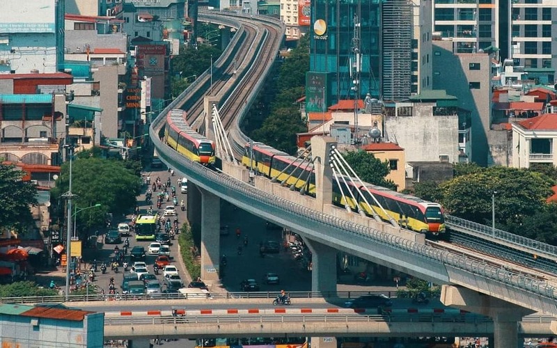
A new sky-monorail transportation system will be constructed along both sides of the river, complemented by the establishment of a waterbus route along the river, seamlessly connecting the two banks of the Red River.
Looking ahead to 2045, the enhancement of the Long Bien Bridge will create a river cruise that explores the historical and cultural heritage from Phu Tho (Hung Temple) – Ancient Son Tay Citadel – Thang Long Imperial Citadel – Co Loa Citadel – Bat Trang Pottery Village – Pho Hien (Hung Yen).
“This will form a cultural and heritage journey along the Red River and interconnected historical sites from Phu Tho to Hanoi to Hung Yen,” he said.
A highlight along the Red River axis is the transformation of the Long Bien Bridge into a pedestrian space for events, exhibitions, cultural festivals, and tourism, representing the new era of Hanoi. The creation of squares on both ends of the bridge will facilitate easy access by public transportation, serve as an architectural axis and cultural space connecting the old and new cities, and foster harmonious blending with the open space of the Red River.
Additionally, the restoration of spiritual architecture along the Red River, such as temples and pagodas from the civilization of the Red River, will be undertaken.
Cultural elements associated with legends, such as the Chu Dong Tu Beach, will be revived to add value and provide an immersive experience in harmony with nature. Parks, scenic green spaces, cultural facilities, entertainment venues, restaurants, tourist services, and urban amenities will be developed to serve the communities.
| "In the current context, Hanoi's decision to identify the Red River axis as the principal axis for development aligns with the city's strategic vision to build a capital that embodies tradition, civilization, and modernity. This decision is deemed timely and appropriate. The urban areas on both sides of the Red River are currently experiencing rapid breakthroughs, laying the foundation for sustainable and harmonious development on both banks. This is a clear and concrete demonstration of the return of the Red River as the city's central development axis, in line with the historical urban development patterns of Thang Long – Hanoi,” Professor Dr. Nguyen Quang Ngoc, Vice Chairman of the Vietnam Association of Historical Science. |